District Guide
West Singhbhum
Tourist Places in West Singhbhum Jharkhand — Saranda Forest, Hirni Falls & Kiriburu
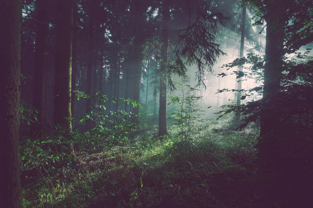
West Singhbhum district (headquartered in Chaibasa) contains one of the largest sal forests in Asia — Saranda Forest, a 833 sq km protected area covering the hilly terrain between the Jharkhand–Odisha border and the Kolhan region. 'Saranda' means 'seven hundred hills' in the Ho tribal language — a geographical description that captures the district's defining character: rolling forested ridges, wide river valleys, and the continuous canopy of a forest that has survived relatively intact through the industrial development on its margins.
The Ho tribal community is the dominant indigenous group of West Singhbhum, and the district has the highest concentration of Ho villages in India. The traditional Ho village architecture — red-mud longhouses with curved thatched roofs arranged in geometric village layouts — is visible throughout the Saranda and Kolhan areas. The Sarhul and Mage Parab festivals maintain the Ho community's distinct ceremonial calendar.
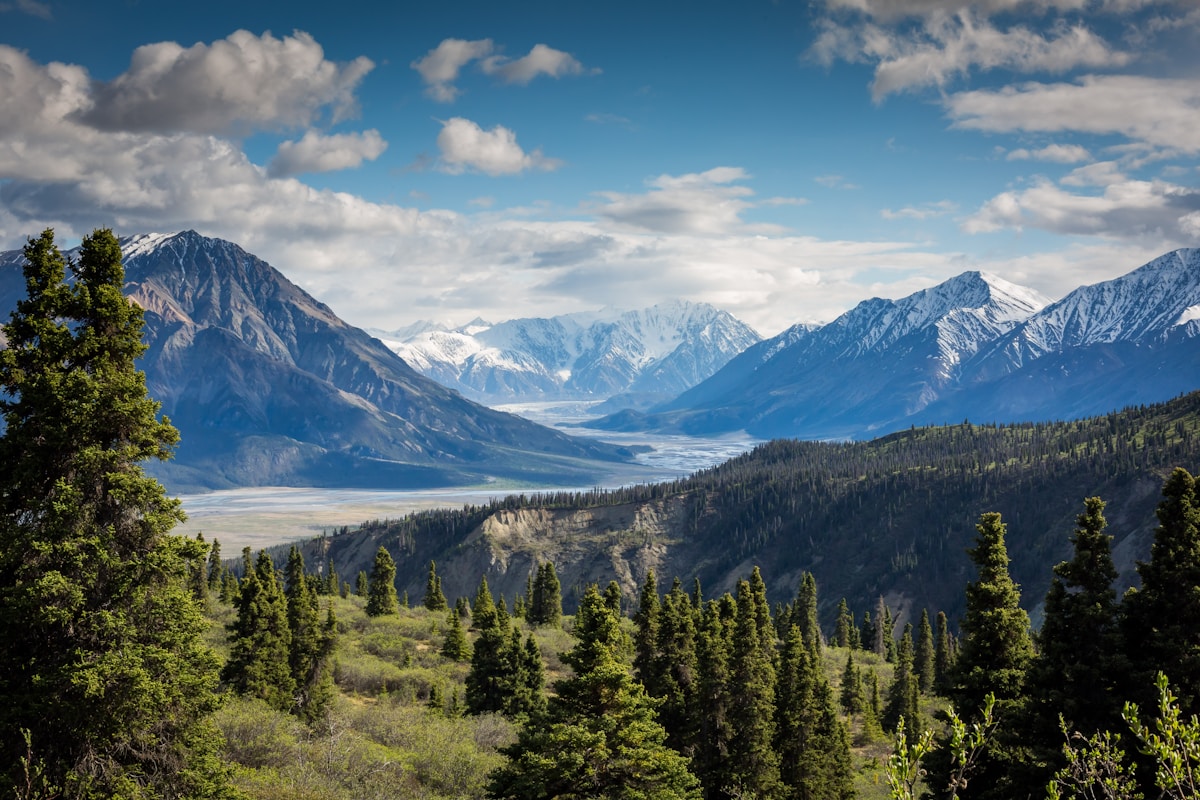
Kiriburu and Meghahatuburu are twin hill towns in the Saranda hills rising to 900+ metres, known simultaneously as active iron-ore mining sites and as viewpoints across the forested terrain. Hirni Falls, 70 km from Ranchi on the South Koel River, is one of Jharkhand's most accessible major waterfalls — a broad cascade that can be combined with a drive into the Saranda forest. The Kharsawan–Chakradharpur archaeological zone along the district's eastern edge contains carved stone panels from the 7th–8th centuries at Benisagar.
All Destinations(9)
 Forest
Tholkobad Jungle Trail
Tholkobad Jungle Trail Saranda — Birdwatching and Trekking in Saranda Forest, Jharkhand
 Waterfall
Hirni Falls
Hirni Falls West Singhbhum — 37-Metre Waterfall Near Chakradharpur, Jharkhand
 Viewpoint
Kiriburu
Kiriburu Saranda — Hilltop Sunset Point in Asia's Largest Sal Forest, West Singhbhum
ViewpointMeghahatuburu
Meghahatuburu Saranda — Hilltop Sunset Viewpoint in Saranda Forest, West Singhbhum
 Tribal Heritage
Benisagar
Benisagar West Singhbhum — Ancient Archaeological Site Near Chaibasa, Jharkhand
 Waterfall
Lupungutu Falls
Lupungutu Falls West Singhbhum — Tribal Forest Waterfall Near Chaibasa, Jharkhand
WaterfallHakigora Falls
Hakigora Falls West Singhbhum — Hidden Waterfall in the Singhbhum Tribal Hills
 Park & Garden
Rungta Garden, Chaibasa
Rungta Garden Chaibasa — Scenic Public Garden in Chaibasa, West Singhbhum
Saranda Forest
Saranda Forest Jharkhand — Asia's Largest Sal Forest, Home to Elephants & Ho Tribe
How to Reach West Singhbhum
- 1Chaibasa: 150 km from Ranchi on NH-75 — 3.5 hours
- 2Hirni Falls: 70 km from Ranchi on the Chakradharpur road — 2 hours
- 3Saranda Forest: enter via Chakradharpur (150 km) or Jagannathpur
- 4Kiriburu–Meghahatuburu: 200 km from Ranchi via Chaibasa and Noamundi — 5 hours
- 5Chakradharpur railway station on the Howrah–Mumbai mainline (closest to Saranda)
- 6Nearest airport: Birsa Munda Airport Ranchi, 150 km to Chaibasa
Frequently Asked Questions About West Singhbhum
Common questions about visiting West Singhbhum, Jharkhand
Saranda Forest in West Singhbhum is one of the largest sal forests in Asia — 833 sq km covering the hill country between Jharkhand and Odisha. 'Saranda' means 'seven hundred hills' in Ho tribal language. The forest is a critical elephant corridor and the homeland of the Ho tribal community. 150 km from Ranchi.
Hirni Falls is 70 km from Ranchi on the road towards Chakradharpur — approximately 2 hours' drive. It is a broad cascade on the South Koel River and one of Jharkhand's most accessible major waterfalls. Best visited October–February when water volume is good.
Kiriburu and Meghahatuburu are twin iron-ore mining hill towns in the Saranda hills of West Singhbhum, rising to 900+ metres. They offer panoramic views across the Saranda forest. 200 km from Ranchi. Best visited November–February for clear-day views.
Plan Your Trip to West Singhbhum
Browse tour packages, book hotels, or hire a car for your West Singhbhum journey.